中国综合性科技类核心期刊(北大核心)
中国科学引文数据库来源期刊(CSCD)
美国《化学文摘》(CA)收录
美国《数学评论》(MR)收录
俄罗斯《文摘杂志》收录
中国综合性科技类核心期刊(北大核心)
中国科学引文数据库来源期刊(CSCD)
美国《化学文摘》(CA)收录
美国《数学评论》(MR)收录
俄罗斯《文摘杂志》收录
| Citation: | KOUROSH NIYA Ali, HUANG Jinliang. The use of remote sensing and GIS to detect and simulate changes in the largest mangrove community of Iran[J]. Journal of East China Normal University (Natural Sciences), 2020, (S1): 94-98. doi: 10.3969/j.issn.1000-5641.202092210

|

| [1] |
OLIVER T H, MORECROFT M D. Interactions between climate change and land use change on biodiversity: Attribution problems, risks, and opportunities [J]. Wiley Interdisciplinary Reviews: Climate Change, 2014, 5(3): 317-335.
|
| [2] |
DILMAGHANI Y, DANEHKAR A, JOZI S A, et al. Codification of mangrove forests management strategies: Case study of Hara Protected Area, Iran [J]. Journal of Food, Agriculture & Environment, 2011, 9(2): 508-513.
|
| [3] |
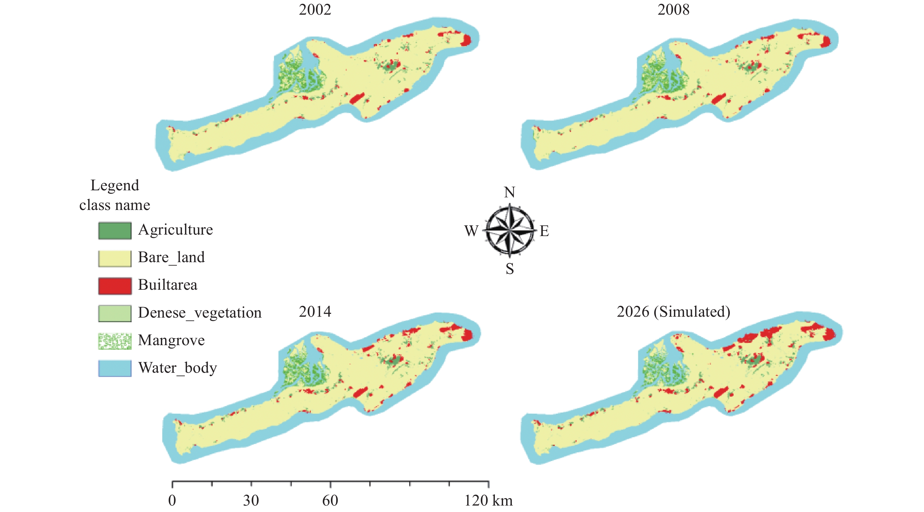
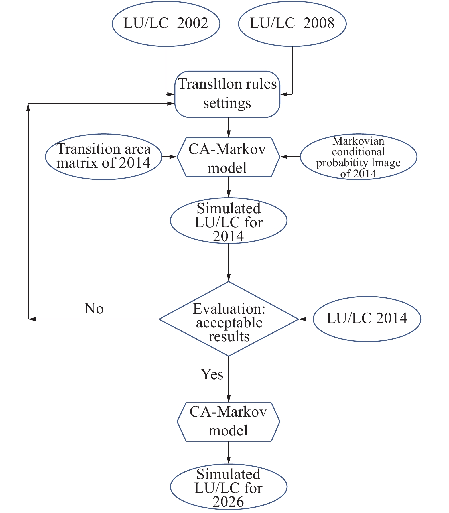
KOUROSH NIYA A, HUANG J, KAZEMZADEH-ZOW A, et al. Comparison of three hybrid models to simulate land use changes: A case study in Qeshm Island, Iran [J]. Environmental Monitoring and Assessment, 2020, 192: 1-19.
|
| [4] |
KHOORANI A, BINEIAZ M, AMIRI H R. Mangrove forest area changes due to climatic changes (Case study: Forest between the port and the Khamir island) [J]. Aquatic Ecology, 2015(5): 100-111.
|
| [5] |
MAFI-GHOLAMI D, ZENNER E K, JAAFARI A, et al. Modeling multi-decadal mangrove leaf area index in response to drought along the semi-arid southern coasts of Iran [J]. Science of the Total Environment, 2019, 656: 1326-1336.
|
Figures(2) / Tables(2)


 DownLoad: